How does ChrysaLabs sampling design improve the bankability of our carbon credits?
Our sampling design starts with uncertainty driven stratification and our own digital soil mapping layers, so every sample point is placed where it adds the most statistical value. That translates into a defensible, audit ready quantification that registries and buyers can trust, and it directly reduces the share of your credits diverted to the buffer pool.
Does ChrysaLabs manage field sampling, or do we need to staff our own crews?
ChrysaLabs runs the full field operation for you, from sampling design through probe deployment, lab coordination, and data consolidation. You get one accountable partner instead of multiple vendors and internal crews to manage, which keeps your project scalable as you add new sites or expand acreage.
How does the ChrysaLabs probe lower lab costs while improving measurement accuracy?
Each probe scan costs a fraction of a traditional lab assay, so you can multiply your sampling density without multiplying your lab budget. The probe also measures a full vertical soil carbon profile across depth increments instead of relying on a single composite sample, which improves your minimum detectable difference (MDD) and feeds the model more precise, depth resolved data. The net effect is lower MRV cost, tighter uncertainty, and more sellable credits per hectare.
How does ChrysaLabs reduce the risk of credit discounting under VM0042?
VM0042 discounts your credits based on measurement uncertainty, and that discount comes straight out of your buffer pool allocation. ChrysaLabs lowers that uncertainty at the source with a sampling design built on stratification and digital soil mapping layers, paired with dense probe measurements that add real information value at every point. Less uncertainty means fewer credits withheld and a stronger, more bankable issuance.
Can ChrysaLabs integrate with our existing registry submission or project management workflow?
Yes. Our data pipeline is built for traceability and version control, so probe, lab, and geospatial data arrive in a format that plugs into your registry submission process and project management tools rather than forcing you to rebuild your workflow around us.
How does proximal sensing reduce MRV costs at scale?
Traditional soil carbon MRV relies entirely on laboratory analysis, costing $50–150 USD per sample — a linear cost driver as projects scale to tens of thousands of acres. ChrysaLabs' proximal sensing technology, once calibrated with a strategic set of lab samples, generates dense in-field measurements at a fraction of lab cost. In the monitoring phase of large projects, this hybrid approach can reduce per-acre MRV costs by 40–60% compared to lab-only methods, while maintaining the data precision required by VM0042. This is what makes enterprise-scale soil carbon projects financially viable: the cost-accuracy tradeoff that blocks lab-only approaches breaks down entirely with proximal sensing.
What is soil carbon MRV?
Soil carbon MRV — Measurement, Reporting, and Verification — is the structured scientific process used to quantify how much carbon dioxide a soil carbon project has sequestered, document it for third-party validation, and generate carbon credits that registries and buyers can trust. A robust MRV framework integrates sampling design, in-situ measurement, laboratory analysis, geospatial modelling, and compliance reporting into a single, traceable data chain. ChrysaLabs delivers end-to-end soil carbon MRV services — from uncertainty-driven sampling design to VM0042-aligned registry reporting — for project developers operating at any stage of their carbon journey.
How does ChrysaLabs reduce issuance risk and maximize credit yield?
ChrysaLabs addresses the root causes of issuance risk at every stage. Uncertainty-driven sampling design ensures every sample generates maximum statistical value, eliminating under-sampling (inflated uncertainty → credit discounts) and over-sampling (inflated cost → reduced ROI). Dense proximal sensing maps soil variability in real time, sharpening strata boundaries that reduce uncertainty at the field level. Automated data pipelines prevent QA/QC failures that commonly fail validation. Deep soil profile measurement (down to 1 meter) strengthens permanence claims. Combined, this approach consistently maximizes the ratio of issued credits to expected credits — the core driver of soil carbon project profitability.
How does ChrysaLabs produce bankable, registry-aligned carbon project documentation?
ChrysaLabs' platform generates project documentation that is designed for third-party validation from day one. This includes: statistically defensible baseline sampling plans, in-field measurement records with GPS tagging and timestamps, automated QA/QC audit trails, carbon stock change calculations with explicit uncertainty ranges, and registry-aligned reports meeting VM0042 format requirements. All data flows through a structured pipeline with full version control, so every number in the final project report is traceable to a specific field measurement or lab analysis. Bureau Veritas has validated that this documentation meets the requirements for VM0042 project validation.
What is measurement uncertainty in soil carbon MRV, and how does ChrysaLabs manage it?
Measurement uncertainty is the statistical margin of error around a carbon stock estimate. Under VM0042, high uncertainty forces a downward discount on issued credits, directly reducing project revenue. ChrysaLabs manages uncertainty at every stage of the MRV workflow: uncertainty-driven sampling design allocates samples where variability is highest and statistical return is greatest; dense proximal sensing reduces the number of costly lab samples while maintaining data precision; and advanced modelling integrates probe signals, lab carbon values, and geospatial features to produce high-accuracy predictions. The combined effect is lower uncertainty per dollar of MRV investment — more bankable credits per acre.
Is ChrysaLabs validated under VM0042?
Yes. ChrysaLabs' proximal sensing technology and MRV methodology have been independently validated under Verra's VM0042 standard by Bureau Veritas. This third-party validation confirms that ChrysaLabs' data collection workflows, machine learning modelling framework, and reporting procedures meet VM0042 requirements for use in carbon credit projects. ChrysaLabs is also ISO certified, GLOSOLAN recognized, a member of the 4 per 1000 Initiative, the B:Carbon program, ISCIA, and the Carbon Development Council — providing multiple independent layers of accreditation.
What does VM0042 compliance require for field sampling and data collection?
VM0042 requires: (1) a stratified sampling design demonstrating sufficient confidence intervals for the claimed carbon quantity, (2) minimum sampling density per strata based on site variability, (3) soil carbon measurement at multiple depths (minimum 0–30 cm; deeper profiles strengthen permanence claims), (4) accredited laboratory analysis for a required subset, (5) transparent QA/QC documentation, and (6) a validated modelling methodology if proxies are used to reduce lab costs. ChrysaLabs' smart sampling design and DSM-based stratification are built specifically to meet these requirements with the minimum number of samples needed to achieve a target uncertainty level — directly optimizing cost per credit.
What is the difference between proximal sensing and remote sensing for soil carbon MRV?
Remote sensing (satellite or drone imagery) captures spectral reflectance at low cost and high coverage but cannot reliably detect below-surface carbon stocks or the spatial variability required by protocols like VM0042. Proximal sensing — direct-contact measurement of the soil — provides the ground-truth data that validation bodies require: high-resolution, multi-depth carbon measurements that are physically verifiable. ChrysaLabs uses proximal sensing as the foundation of its MRV framework, integrating it with digital soil mapping (DSM) covariates to combine the density of ground-truth measurement with the spatial coverage of geospatial data. This hybrid approach outperforms either method alone on the accuracy-cost tradeoff.
What is issuance risk in a carbon credit project, and how significant is it?
Issuance risk is the gap between the expected credit yield estimated at project design and the verified credits actually issued after measurement and validation. It arises from measurement uncertainty (which forces conservative credit calculations), insufficient sampling density, QA/QC failures, and lack of vertical soil profile data. In poorly designed MRV programs, issuance risk can reduce realized credit volumes by 20–40%. ChrysaLabs' framework is engineered to minimize issuance risk through uncertainty-driven sampling design, dense proximal sensing, and rigorous data traceability — maximizing the ratio of verified credits to expected credits on every acre.
What is VM0042, and why does it matter for soil carbon projects?
VM0042 is Verra's Methodology for Improved Agricultural Land Management — the leading global standard for quantifying and crediting soil carbon sequestration from agricultural practice changes. It defines rigorous requirements for baseline measurement, monitoring frequency, stratification, uncertainty quantification, and permanence accounting. Credits issued under VM0042 are accepted by major buyers and registries globally, making it the de facto standard for institutional-grade soil carbon credits. ChrysaLabs is one of the few MRV providers with technology and workflows independently validated under VM0042 by Bureau Veritas, enabling project developers to produce fully compliant, verification-ready documentation at scale.
What is additionality in soil carbon projects, and how is it measured?
Additionality is the demonstration that carbon sequestration in a project would not have occurred without the carbon credit incentive — i.e., the practice change (reduced tillage, cover crops, etc.) is viable only because of carbon revenue. Demonstrating additionality requires a credible baseline — measured soil carbon stocks under the counterfactual scenario — and net stock change measurements attributable to the new practice. Under VM0042, additionality assessment is a core component of project design and must be documented with field-level data collected using validated methodology. ChrysaLabs designs baseline sampling plans specifically to provide the ground-truth additionality evidence required by registries.
Can ChrysaLabs estimate expected carbon credit yield before field operations begin?
Yes. ChrysaLabs provides economic feasibility assessments as part of its project design services. Using existing soil data, satellite-derived covariates, and regional carbon sequestration benchmarks, ChrysaLabs' calculator estimates expected carbon stock change, associated uncertainty, and resulting credit yield for a proposed project area. This assessment helps project developers determine whether a site and practice change can generate sufficient credits to justify MRV investment — before committing to sampling costs. The assessment also optimizes the sampling strategy to maximize expected credit revenue against a given MRV budget, improving financial predictability at the earliest project stage.
What is the ROI of ChrysaLabs’ MRV approach vs. conventional lab sampling?
The ROI advantage of ChrysaLabs' approach operates on two dimensions: (1) higher credit yield per acre from lower uncertainty and more complete soil carbon accounting (including vertical profile down to 1 meter); and (2) lower per-sample cost from proximal sensing at scale. The combination produces a higher revenue-to-cost ratio than conventional approaches, particularly at project sizes above 10,000 acres where lab-only sampling costs become prohibitive. ChrysaLabs' profitability calculator, used in feasibility assessments, quantifies these gains for specific project geographies and practice change scenarios. Contact our team to run a scenario analysis for your project.
How does ChrysaLabs handle the tradeoff between sampling accuracy and operational cost?
ChrysaLabs' framework is specifically engineered to break the traditional accuracy-cost tradeoff in soil carbon MRV. The conventional approach forces a choice: more lab samples (higher accuracy, higher cost) or fewer samples (lower cost, higher uncertainty and credit discounts). ChrysaLabs' hybrid model — dense proximal sensing calibrated against a strategic number of lab samples — delivers accuracy equivalent to full lab coverage at a fraction of the cost. Uncertainty-driven sampling design further optimizes this: by concentrating samples where variability is highest, each sample added generates maximum information value. The result is a monitoring plan that scales without a proportional cost increase.
Can ChrysaLabs work with existing carbon program infrastructure, platforms, or registries?
Yes. ChrysaLabs integrates with the data infrastructure and workflows of carbon program operators, agronomic service providers, and registry platforms. Our data pipeline exports in formats compatible with major carbon accounting software and registry submission systems. ChrysaLabs is Verra VM0042 compliant, works with B:Carbon, and has established working relationships with project developers and validators globally. If you are developing a carbon program and evaluating MRV partners, contact our team to discuss how ChrysaLabs fits into your existing infrastructure.
How does ChrysaLabs support projects at different stages — from feasibility to long-term monitoring?
ChrysaLabs structures its MRV services around three project lifecycle stages. Getting Started: feasibility and economic assessment, methodology selection (VM0042 and others), baseline sampling design, and registry-aligned project documentation — building a credible, investable carbon management foundation. Building Momentum: reliable baseline measurements, validation-ready documentation, and structured data management to keep projects on track toward third-party validation under tight timelines. Scaling: deployment of proximal sensing technology to reduce per-acre monitoring costs, building a project-specific ML model that blends dense field data with strategic lab samples — enabling high-precision monitoring at a cost that makes large-scale, long-term programs financially sustainable.
What geographic markets does ChrysaLabs operate in?
ChrysaLabs has conducted soil carbon MRV field operations in 10+ countries across North America, South America, and Europe. Our soil carbon dataset includes samples from diverse soil types, climatic zones, and agricultural systems — which improves model accuracy across geographies and reduces the calibration burden for new projects. International project developers should contact us to discuss geographic coverage, local partnerships, and protocol applicability for their specific region.
How does ChrysaLabs manage large-scale field sampling operations?
After 6 million+ acres of field operations, ChrysaLabs has developed a disciplined operational model: trained field crews, strict quality assurance protocols, professional grower communication workflows, and safe execution in challenging terrain. For enterprise-scale programs, ChrysaLabs manages field logistics end-to-end — from crew deployment and equipment management to real-time data upload and QA flag resolution. This operational infrastructure ensures accurate MRV data at the pace large carbon programs require, without the data quality failures that commonly arise when sampling operations are fragmented across multiple contractors.
What scale of carbon projects can ChrysaLabs support?
ChrysaLabs has supported projects ranging from pilot-scale assessments of a few thousand acres to enterprise programs exceeding 90,000 acres — including a landmark collaboration with Agoro Carbon Alliance. Across all projects, ChrysaLabs has measured over 5 million acres and accumulated more than 400,000 ground-truth soil data points in 10+ countries, building one of the world's largest calibrated soil carbon datasets. This scale of historical data improves model accuracy for new projects in similar geographies — a compounding advantage unavailable to first-time MRV providers.
How does ChrysaLabs ensure data traceability and auditability from field to report?
All data collected by ChrysaLabs — probe measurements, GPS coordinates, lab results, QA/QC flags, version history — flows through an automated data pipeline with a full audit trail. Each sample is geotagged and timestamped at the field level. The data chain from in-situ measurement to final carbon stock estimate is documented in a format compatible with registry submissions and third-party validation review. ChrysaLabs' platform provides version control and project-ready documentation at scale, ensuring that validation bodies can trace every data point in the project report. This transparency is a core requirement for bankable carbon projects — and the reason ChrysaLabs' documentation passes Bureau Veritas validation review.
How accurate is ChrysaLabs’ technology compared to laboratory analysis?
ChrysaLabs' carbon predictions are calibrated against accredited laboratory analysis, with accuracy independently validated under VM0042 by Bureau Veritas. In operational projects, ChrysaLabs achieves prediction errors comparable to inter-laboratory variability between accredited soil testing facilities — meaning that at scale, its measurements are as reliable as traditional wet chemistry analysis for carbon credit quantification. Accuracy improves with project-specific calibration: as ChrysaLabs builds a site-specific model using local lab samples, prediction quality increases with each additional measurement cycle. The accredited lab samples serve as anchor points that ensure the model remains within validation-grade accuracy throughout the monitoring period.
To what depths does ChrysaLabs measure soil carbon, and why does it matter?
ChrysaLabs' technology measures soil carbon at variable depths from 4 to 30 inches (approximately 10 to 75 cm), with the capability to sample the full profile down to one meter. Depth matters for two reasons: first, a significant portion of total soil organic carbon is stored in subsurface layers (30–100 cm), and excluding it systematically understates carbon stock and credit yield. Second, deep profile measurement strengthens permanence claims — carbon stored at depth is less susceptible to reversal from tillage or surface disturbance. ChrysaLabs' vertical carbon measurement capability is a key differentiator in meeting the most rigorous protocol requirements for permanence accounting.
What is digital soil mapping (DSM), and how does ChrysaLabs use it?
Digital soil mapping (DSM) uses geospatial covariates — satellite imagery, terrain models, land use history, climate data — to predict soil properties at unsampled locations. ChrysaLabs uses DSM layers to stratify project areas before field operations, identifying zones of similar expected soil carbon variability. This pre-stratification ensures sampling resources are concentrated where they generate the most statistical value, reducing the total samples needed to achieve a target uncertainty level. Post-measurement, ChrysaLabs integrates DSM predictions with probe data and lab results in its modelling framework to produce spatially explicit carbon stock estimates across the full project area.
How does ChrysaLabs’ proximal sensing technology measure soil organic carbon (SOC)?
ChrysaLabs' probe uses an array of sensors — including near-infrared (NIR) spectroscopy — to take a physical scan of the soil at the measurement point. Sensor data is uploaded to the cloud, where a project-specific machine learning model — calibrated against accredited laboratory carbon analysis — translates signals into highly accurate soil organic carbon (SOC) measurements. Each measurement takes approximately 25 seconds and can be performed at variable depths from 4 to 30 inches, enabling ChrysaLabs to map the full soil carbon profile. The technology can complete a measurement density that would require months of lab sampling in days of field operations, making it the foundation of a scalable MRV framework.
What data do carbon registries require for soil carbon project verification?
Carbon registries — including Verra under VM0042 — require a traceable data chain covering: (1) a statistically defensible baseline sampling design with documented stratification, (2) soil carbon measurements at sufficient depth and spatial density to quantify permanence, (3) accredited laboratory analysis for a required sample subset, (4) full QA/QC documentation and methodology transparency, (5) carbon stock change calculations with explicit uncertainty bounds, and (6) evidence of additionality. All data must enable third-party validation without significant gaps. ChrysaLabs' platform generates registry-ready documentation at every stage of a project, including version control and audit trail for each data point from field to final report.
How does proximal sensing reduce MRV costs at scale?
Traditional soil carbon MRV relies entirely on laboratory analysis, costing $50–150 USD per sample — a linear cost driver as projects scale to tens of thousands of acres. ChrysaLabs' proximal sensing technology, once calibrated with a strategic set of lab samples, generates dense in-field measurements at a fraction of lab cost. In the monitoring phase of large projects, this hybrid approach can reduce per-acre MRV costs by 40–60% compared to lab-only methods, while maintaining the data precision required by VM0042. This is what makes enterprise-scale soil carbon projects financially viable: the cost-accuracy tradeoff that blocks lab-only approaches breaks down entirely with proximal sensing.
What is soil carbon MRV?
Soil carbon MRV — Measurement, Reporting, and Verification — is the structured scientific process used to quantify how much carbon dioxide a soil carbon project has sequestered, document it for third-party validation, and generate carbon credits that registries and buyers can trust. A robust MRV framework integrates sampling design, in-situ measurement, laboratory analysis, geospatial modelling, and compliance reporting into a single, traceable data chain. ChrysaLabs delivers end-to-end soil carbon MRV services — from uncertainty-driven sampling design to VM0042-aligned registry reporting — for project developers operating at any stage of their carbon journey.
How does ChrysaLabs reduce issuance risk and maximize credit yield?
ChrysaLabs addresses the root causes of issuance risk at every stage. Uncertainty-driven sampling design ensures every sample generates maximum statistical value, eliminating under-sampling (inflated uncertainty → credit discounts) and over-sampling (inflated cost → reduced ROI). Dense proximal sensing maps soil variability in real time, sharpening strata boundaries that reduce uncertainty at the field level. Automated data pipelines prevent QA/QC failures that commonly fail validation. Deep soil profile measurement (down to 1 meter) strengthens permanence claims. Combined, this approach consistently maximizes the ratio of issued credits to expected credits — the core driver of soil carbon project profitability.
How does ChrysaLabs produce bankable, registry-aligned carbon project documentation?
ChrysaLabs' platform generates project documentation that is designed for third-party validation from day one. This includes: statistically defensible baseline sampling plans, in-field measurement records with GPS tagging and timestamps, automated QA/QC audit trails, carbon stock change calculations with explicit uncertainty ranges, and registry-aligned reports meeting VM0042 format requirements. All data flows through a structured pipeline with full version control, so every number in the final project report is traceable to a specific field measurement or lab analysis. Bureau Veritas has validated that this documentation meets the requirements for VM0042 project validation.
What is measurement uncertainty in soil carbon MRV, and how does ChrysaLabs manage it?
Measurement uncertainty is the statistical margin of error around a carbon stock estimate. Under VM0042, high uncertainty forces a downward discount on issued credits, directly reducing project revenue. ChrysaLabs manages uncertainty at every stage of the MRV workflow: uncertainty-driven sampling design allocates samples where variability is highest and statistical return is greatest; dense proximal sensing reduces the number of costly lab samples while maintaining data precision; and advanced modelling integrates probe signals, lab carbon values, and geospatial features to produce high-accuracy predictions. The combined effect is lower uncertainty per dollar of MRV investment — more bankable credits per acre.
Is ChrysaLabs validated under VM0042?
Yes. ChrysaLabs' proximal sensing technology and MRV methodology have been independently validated under Verra's VM0042 standard by Bureau Veritas. This third-party validation confirms that ChrysaLabs' data collection workflows, machine learning modelling framework, and reporting procedures meet VM0042 requirements for use in carbon credit projects. ChrysaLabs is also ISO certified, GLOSOLAN recognized, a member of the 4 per 1000 Initiative, the B:Carbon program, ISCIA, and the Carbon Development Council — providing multiple independent layers of accreditation.
What does VM0042 compliance require for field sampling and data collection?
VM0042 requires: (1) a stratified sampling design demonstrating sufficient confidence intervals for the claimed carbon quantity, (2) minimum sampling density per strata based on site variability, (3) soil carbon measurement at multiple depths (minimum 0–30 cm; deeper profiles strengthen permanence claims), (4) accredited laboratory analysis for a required subset, (5) transparent QA/QC documentation, and (6) a validated modelling methodology if proxies are used to reduce lab costs. ChrysaLabs' smart sampling design and DSM-based stratification are built specifically to meet these requirements with the minimum number of samples needed to achieve a target uncertainty level — directly optimizing cost per credit.
What is the difference between proximal sensing and remote sensing for soil carbon MRV?
Remote sensing (satellite or drone imagery) captures spectral reflectance at low cost and high coverage but cannot reliably detect below-surface carbon stocks or the spatial variability required by protocols like VM0042. Proximal sensing — direct-contact measurement of the soil — provides the ground-truth data that validation bodies require: high-resolution, multi-depth carbon measurements that are physically verifiable. ChrysaLabs uses proximal sensing as the foundation of its MRV framework, integrating it with digital soil mapping (DSM) covariates to combine the density of ground-truth measurement with the spatial coverage of geospatial data. This hybrid approach outperforms either method alone on the accuracy-cost tradeoff.
What is issuance risk in a carbon credit project, and how significant is it?
Issuance risk is the gap between the expected credit yield estimated at project design and the verified credits actually issued after measurement and validation. It arises from measurement uncertainty (which forces conservative credit calculations), insufficient sampling density, QA/QC failures, and lack of vertical soil profile data. In poorly designed MRV programs, issuance risk can reduce realized credit volumes by 20–40%. ChrysaLabs' framework is engineered to minimize issuance risk through uncertainty-driven sampling design, dense proximal sensing, and rigorous data traceability — maximizing the ratio of verified credits to expected credits on every acre.
What is VM0042, and why does it matter for soil carbon projects?
VM0042 is Verra's Methodology for Improved Agricultural Land Management — the leading global standard for quantifying and crediting soil carbon sequestration from agricultural practice changes. It defines rigorous requirements for baseline measurement, monitoring frequency, stratification, uncertainty quantification, and permanence accounting. Credits issued under VM0042 are accepted by major buyers and registries globally, making it the de facto standard for institutional-grade soil carbon credits. ChrysaLabs is one of the few MRV providers with technology and workflows independently validated under VM0042 by Bureau Veritas, enabling project developers to produce fully compliant, verification-ready documentation at scale.
What is additionality in soil carbon projects, and how is it measured?
Additionality is the demonstration that carbon sequestration in a project would not have occurred without the carbon credit incentive — i.e., the practice change (reduced tillage, cover crops, etc.) is viable only because of carbon revenue. Demonstrating additionality requires a credible baseline — measured soil carbon stocks under the counterfactual scenario — and net stock change measurements attributable to the new practice. Under VM0042, additionality assessment is a core component of project design and must be documented with field-level data collected using validated methodology. ChrysaLabs designs baseline sampling plans specifically to provide the ground-truth additionality evidence required by registries.
Can ChrysaLabs estimate expected carbon credit yield before field operations begin?
Yes. ChrysaLabs provides economic feasibility assessments as part of its project design services. Using existing soil data, satellite-derived covariates, and regional carbon sequestration benchmarks, ChrysaLabs' calculator estimates expected carbon stock change, associated uncertainty, and resulting credit yield for a proposed project area. This assessment helps project developers determine whether a site and practice change can generate sufficient credits to justify MRV investment — before committing to sampling costs. The assessment also optimizes the sampling strategy to maximize expected credit revenue against a given MRV budget, improving financial predictability at the earliest project stage.
What is the ROI of ChrysaLabs’ MRV approach vs. conventional lab sampling?
The ROI advantage of ChrysaLabs' approach operates on two dimensions: (1) higher credit yield per acre from lower uncertainty and more complete soil carbon accounting (including vertical profile down to 1 meter); and (2) lower per-sample cost from proximal sensing at scale. The combination produces a higher revenue-to-cost ratio than conventional approaches, particularly at project sizes above 10,000 acres where lab-only sampling costs become prohibitive. ChrysaLabs' profitability calculator, used in feasibility assessments, quantifies these gains for specific project geographies and practice change scenarios. Contact our team to run a scenario analysis for your project.
How does ChrysaLabs handle the tradeoff between sampling accuracy and operational cost?
ChrysaLabs' framework is specifically engineered to break the traditional accuracy-cost tradeoff in soil carbon MRV. The conventional approach forces a choice: more lab samples (higher accuracy, higher cost) or fewer samples (lower cost, higher uncertainty and credit discounts). ChrysaLabs' hybrid model — dense proximal sensing calibrated against a strategic number of lab samples — delivers accuracy equivalent to full lab coverage at a fraction of the cost. Uncertainty-driven sampling design further optimizes this: by concentrating samples where variability is highest, each sample added generates maximum information value. The result is a monitoring plan that scales without a proportional cost increase.
Can ChrysaLabs work with existing carbon program infrastructure, platforms, or registries?
Yes. ChrysaLabs integrates with the data infrastructure and workflows of carbon program operators, agronomic service providers, and registry platforms. Our data pipeline exports in formats compatible with major carbon accounting software and registry submission systems. ChrysaLabs is Verra VM0042 compliant, works with B:Carbon, and has established working relationships with project developers and validators globally. If you are developing a carbon program and evaluating MRV partners, contact our team to discuss how ChrysaLabs fits into your existing infrastructure.
How does ChrysaLabs support projects at different stages — from feasibility to long-term monitoring?
ChrysaLabs structures its MRV services around three project lifecycle stages. Getting Started: feasibility and economic assessment, methodology selection (VM0042 and others), baseline sampling design, and registry-aligned project documentation — building a credible, investable carbon management foundation. Building Momentum: reliable baseline measurements, validation-ready documentation, and structured data management to keep projects on track toward third-party validation under tight timelines. Scaling: deployment of proximal sensing technology to reduce per-acre monitoring costs, building a project-specific ML model that blends dense field data with strategic lab samples — enabling high-precision monitoring at a cost that makes large-scale, long-term programs financially sustainable.
What geographic markets does ChrysaLabs operate in?
ChrysaLabs has conducted soil carbon MRV field operations in 10+ countries across North America, South America, and Europe. Our soil carbon dataset includes samples from diverse soil types, climatic zones, and agricultural systems — which improves model accuracy across geographies and reduces the calibration burden for new projects. International project developers should contact us to discuss geographic coverage, local partnerships, and protocol applicability for their specific region.
How does ChrysaLabs manage large-scale field sampling operations?
After 6 million+ acres of field operations, ChrysaLabs has developed a disciplined operational model: trained field crews, strict quality assurance protocols, professional grower communication workflows, and safe execution in challenging terrain. For enterprise-scale programs, ChrysaLabs manages field logistics end-to-end — from crew deployment and equipment management to real-time data upload and QA flag resolution. This operational infrastructure ensures accurate MRV data at the pace large carbon programs require, without the data quality failures that commonly arise when sampling operations are fragmented across multiple contractors.
What scale of carbon projects can ChrysaLabs support?
ChrysaLabs has supported projects ranging from pilot-scale assessments of a few thousand acres to enterprise programs exceeding 90,000 acres — including a landmark collaboration with Agoro Carbon Alliance. Across all projects, ChrysaLabs has measured over 5 million acres and accumulated more than 400,000 ground-truth soil data points in 10+ countries, building one of the world's largest calibrated soil carbon datasets. This scale of historical data improves model accuracy for new projects in similar geographies — a compounding advantage unavailable to first-time MRV providers.
How does ChrysaLabs ensure data traceability and auditability from field to report?
All data collected by ChrysaLabs — probe measurements, GPS coordinates, lab results, QA/QC flags, version history — flows through an automated data pipeline with a full audit trail. Each sample is geotagged and timestamped at the field level. The data chain from in-situ measurement to final carbon stock estimate is documented in a format compatible with registry submissions and third-party validation review. ChrysaLabs' platform provides version control and project-ready documentation at scale, ensuring that validation bodies can trace every data point in the project report. This transparency is a core requirement for bankable carbon projects — and the reason ChrysaLabs' documentation passes Bureau Veritas validation review.
How accurate is ChrysaLabs’ technology compared to laboratory analysis?
ChrysaLabs' carbon predictions are calibrated against accredited laboratory analysis, with accuracy independently validated under VM0042 by Bureau Veritas. In operational projects, ChrysaLabs achieves prediction errors comparable to inter-laboratory variability between accredited soil testing facilities — meaning that at scale, its measurements are as reliable as traditional wet chemistry analysis for carbon credit quantification. Accuracy improves with project-specific calibration: as ChrysaLabs builds a site-specific model using local lab samples, prediction quality increases with each additional measurement cycle. The accredited lab samples serve as anchor points that ensure the model remains within validation-grade accuracy throughout the monitoring period.
To what depths does ChrysaLabs measure soil carbon, and why does it matter?
ChrysaLabs' technology measures soil carbon at variable depths from 4 to 30 inches (approximately 10 to 75 cm), with the capability to sample the full profile down to one meter. Depth matters for two reasons: first, a significant portion of total soil organic carbon is stored in subsurface layers (30–100 cm), and excluding it systematically understates carbon stock and credit yield. Second, deep profile measurement strengthens permanence claims — carbon stored at depth is less susceptible to reversal from tillage or surface disturbance. ChrysaLabs' vertical carbon measurement capability is a key differentiator in meeting the most rigorous protocol requirements for permanence accounting.
What is digital soil mapping (DSM), and how does ChrysaLabs use it?
Digital soil mapping (DSM) uses geospatial covariates — satellite imagery, terrain models, land use history, climate data — to predict soil properties at unsampled locations. ChrysaLabs uses DSM layers to stratify project areas before field operations, identifying zones of similar expected soil carbon variability. This pre-stratification ensures sampling resources are concentrated where they generate the most statistical value, reducing the total samples needed to achieve a target uncertainty level. Post-measurement, ChrysaLabs integrates DSM predictions with probe data and lab results in its modelling framework to produce spatially explicit carbon stock estimates across the full project area.
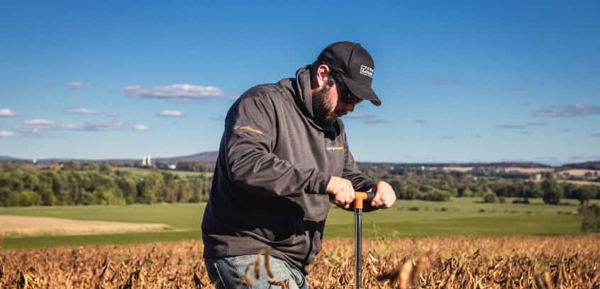
How does ChrysaLabs’ proximal sensing technology measure soil organic carbon (SOC)?
ChrysaLabs' probe uses an array of sensors — including near-infrared (NIR) spectroscopy — to take a physical scan of the soil at the measurement point. Sensor data is uploaded to the cloud, where a project-specific machine learning model — calibrated against accredited laboratory carbon analysis — translates signals into highly accurate soil organic carbon (SOC) measurements. Each measurement takes approximately 25 seconds and can be performed at variable depths from 4 to 30 inches, enabling ChrysaLabs to map the full soil carbon profile. The technology can complete a measurement density that would require months of lab sampling in days of field operations, making it the foundation of a scalable MRV framework.
What data do carbon registries require for soil carbon project verification?
Carbon registries — including Verra under VM0042 — require a traceable data chain covering: (1) a statistically defensible baseline sampling design with documented stratification, (2) soil carbon measurements at sufficient depth and spatial density to quantify permanence, (3) accredited laboratory analysis for a required sample subset, (4) full QA/QC documentation and methodology transparency, (5) carbon stock change calculations with explicit uncertainty bounds, and (6) evidence of additionality. All data must enable third-party validation without significant gaps. ChrysaLabs' platform generates registry-ready documentation at every stage of a project, including version control and audit trail for each data point from field to final report.
How does ChrysaLabs sampling design improve the bankability of our carbon credits?
Our sampling design starts with uncertainty driven stratification and our own digital soil mapping layers, so every sample point is placed where it adds the most statistical value. That translates into a defensible, audit ready quantification that registries and buyers can trust, and it directly reduces the share of your credits diverted to the buffer pool.
Does ChrysaLabs manage field sampling, or do we need to staff our own crews?
ChrysaLabs runs the full field operation for you, from sampling design through probe deployment, lab coordination, and data consolidation. You get one accountable partner instead of multiple vendors and internal crews to manage, which keeps your project scalable as you add new sites or expand acreage.
How does the ChrysaLabs probe lower lab costs while improving measurement accuracy?
Each probe scan costs a fraction of a traditional lab assay, so you can multiply your sampling density without multiplying your lab budget. The probe also measures a full vertical soil carbon profile across depth increments instead of relying on a single composite sample, which improves your minimum detectable difference (MDD) and feeds the model more precise, depth resolved data. The net effect is lower MRV cost, tighter uncertainty, and more sellable credits per hectare.
How does ChrysaLabs reduce the risk of credit discounting under VM0042?
VM0042 discounts your credits based on measurement uncertainty, and that discount comes straight out of your buffer pool allocation. ChrysaLabs lowers that uncertainty at the source with a sampling design built on stratification and digital soil mapping layers, paired with dense probe measurements that add real information value at every point. Less uncertainty means fewer credits withheld and a stronger, more bankable issuance.
Can ChrysaLabs integrate with our existing registry submission or project management workflow?
Yes. Our data pipeline is built for traceability and version control, so probe, lab, and geospatial data arrive in a format that plugs into your registry submission process and project management tools rather than forcing you to rebuild your workflow around us.